States are divided into regions, with each region having it’s own Regional Steward and list of crags.
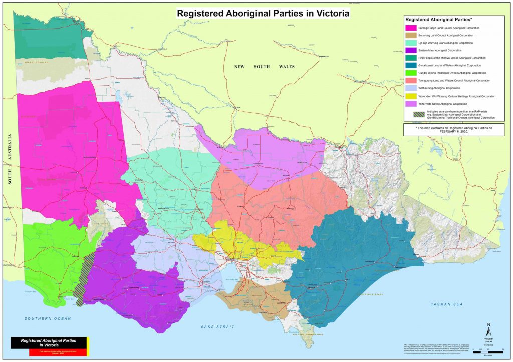
Since climbing areas are increasingly falling under the management and control of Registered Aboriginal Parties, we have assigned climbing areas on the map according to the country of the relevant Aboriginal group.
The menu on the below (and on the left) shows the different areas, with a summary of the climbing in that area.
- Dja Dja Wurrung Country (Central Vic)
- Grampians / Gariwerd
- Gunaikurnai, Bunurong, Yorta Yorta and Millewa-Mallee Countries
- Taungurung Country (NE Vic)
- Wadawurrung Country (Near-SW)
- Wotjobaluk Country (W)
- Wurundjeri Country (Melbourne and Surrounds)
- Gunditjmara Country (Far SW)
- Eastern Maar Country (Mid-SW)
Some individual crags also have their own access pages:
- Black Hill
- Camels Hump / Geburrh
- Cathedral Ranges / Nah Nah Dong
- Kooyoora, Mt Hope, Cobaw
- Mt Alexander / Leeanganook
- Mt Arapiles / Djurrite
- Mt Buffalo / Dordordonga
- Werribee Gorge (Falcon’s Lookout)
- You Yangs / Wurdi Youang
- Ben Nevis (Mt Cole)
Hopefully we can create a more user-friendly ‘clickable map’ soon.
Registered Aboriginal Parties (RAP’s) for Victoria


